Property Record
11754 Hastings Bridge Rd, Hampton, GA 30228


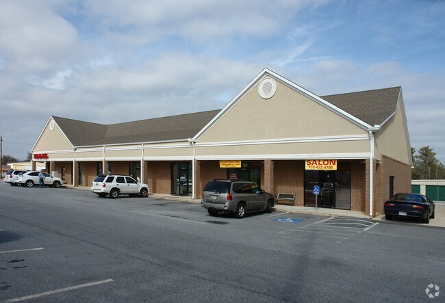

NEARBY LISTINGS FOR SALE OR LEASE
Property Detail
11754 Hastings Bridge Rd
06-00132-165-002
Vishal 1 Llc
Publicstorage
Clayton
X
Georgia
13151C0145D
165
2025
4.30 AC
2025
W Henry/Spalding
040606
Atlanta
6,440 SF
Atlanta-Sandy Springs-Roswell, GA
DEMOGRAPHICS near 11754 Hastings Bridge Rd
1 Mile
3 Mile
5 Mile
2024 Total Population
6,434
31,494
75,119
2029 Population
6,692
32,678
77,809
Pop Growth 2024-2029
+ 4.01%
+ 3.76%
+ 3.58%
Average Age
34
36
37
2024 Total Households
2,090
10,336
24,997
HH Growth 2024-2029
+ 4.31%
+ 3.80%
+ 3.58%
Median Household Inc
$58,815
$64,660
$72,301
Avg Household Size
2.80
2.90
2.90
2024 Avg HH Vehicles
2.00
2.00
2.00
Median Home Value
$186,256
$195,262
$222,496
Median Year Built
2006
2003
2000
Nearby Places
Map Layers
Map Styles
 Street
 Aerial
- Restaurants
- Banks
- Shops
- Fitness
- Groceries
PUBLIC TRANSPORTATION
AIRPORT
Hartsfield - Jackson Atlanta International
DRIVE
WALK
Distance
Hartsfield - Jackson Atlanta International
30 min
18.0 mi
Freight Ports
Georgia Ports - Savannah
DRIVE
WALK
Distance
Georgia Ports - Savannah
255 min
227.8 mi
Nearby Properties
Address
Land Use
TOTAL SIZE
Lot Size
Zoning
Address
Land Use
TOTAL SIZE
Lot Size
Zoning
269,130 SF
15.78 AC
C
Address
Land Use
TOTAL SIZE
Lot Size
Zoning
3,437 SF
121.60 AC
AG
Address
Land Use
TOTAL SIZE
Lot Size
Zoning
344,076 SF
69.14 AC
AG
Address
Land Use
TOTAL SIZE
Lot Size
Zoning
250 SF
23.09 AC
C
Address
Land Use
TOTAL SIZE
Lot Size
Zoning
240 SF
30 AC
RM
Address
Land Use
TOTAL SIZE
Lot Size
Zoning
224 SF
20 AC
C
Address
Land Use
TOTAL SIZE
Lot Size
Zoning
194,270 SF
24.27 AC
C
Address
Land Use
TOTAL SIZE
Lot Size
Zoning
21.01 AC
C
Address
Land Use
TOTAL SIZE
Lot Size
Zoning
18,990 SF
13.11 AC
C
Address
Land Use
TOTAL SIZE
Lot Size
Zoning
5,529 SF
26.29 AC
OI
Address
Land Use
TOTAL SIZE
Lot Size
Zoning
54,499 SF
10.18 AC
GB
Address
Land Use
TOTAL SIZE
Lot Size
Zoning
42,762 SF
6 AC
C
Address
Land Use
TOTAL SIZE
Lot Size
Zoning
289 SF
50.20 AC
C
Address
Land Use
TOTAL SIZE
Lot Size
Zoning
34,563 SF
4.88 AC
C
Address
Land Use
TOTAL SIZE
Lot Size
Zoning
26,297 SF
77 AC
AG
Address
Land Use
TOTAL SIZE
Lot Size
Zoning
47,057 SF
6.83 AC
C
Address
Land Use
TOTAL SIZE
Lot Size
Zoning
9.19 AC
C
Address
Land Use
TOTAL SIZE
Lot Size
Zoning
188,814 SF
54.12 AC
RA
Address
Land Use
TOTAL SIZE
Lot Size
Zoning
147,861 SF
36.79 AC
M1
Address
Land Use
TOTAL SIZE
Lot Size
Zoning
75,588 SF
42.52 AC
Address
Land Use
TOTAL SIZE
Lot Size
Zoning
1,826 SF
169.71 AC
C
Address
Land Use
TOTAL SIZE
Lot Size
Zoning
3,648 SF
533.15 AC
AG
Address
Land Use
TOTAL SIZE
Lot Size
Zoning
8.44 AC
C
Address
Land Use
TOTAL SIZE
Lot Size
Zoning
1,750 SF
5.13 AC
GB
Address
Land Use
TOTAL SIZE
Lot Size
Zoning
5,008 SF
423.50 AC
AG
Address
Land Use
TOTAL SIZE
Lot Size
Zoning
22,948 SF
4.40 AC
AG
Address
Land Use
TOTAL SIZE
Lot Size
Zoning
80,166 SF
95.23 AC
HI
Address
Land Use
TOTAL SIZE
Lot Size
Zoning
26.60 AC
C
Address
Land Use
TOTAL SIZE
Lot Size
Zoning
371,928 SF
10.16 AC
M1
Address
Land Use
TOTAL SIZE
Lot Size
Zoning
11,126 SF
2.89 AC
C
The World's #1 Commercial Real Estate Marketplace
Connect with us
© 2025 CoStar Group
The information above has been obtained from sources believed reliable. While we do not doubt its accuracy we have not verified it and make no guarantee, warranty or representation about it. It is your responsibility to independently confirm its accuracy and completeness. Any projections, opinions, assumptions, or estimates used are for example only and do not represent the current or future performance of the property. The value of this transaction to you depends on tax and other factors which should be evaluated by your tax, financial, and legal advisors. You and your advisors should conduct a careful, independent investigation of the property to determine to your satisfaction the suitability of the property for your needs.